Friday, May 29, 2015

The Loneliest Road

Back in 1986 a Life Magazine article was said to have named US Highway 50 through Nevada as “The Loneliest Road”.  After this a AAA spokesperson said "It's totally empty. There are no points of interest. We don't recommend it. We warn all motorists not to drive there unless they're confident of their survival skills."


Of course the communities along the route, which roughly follows the old Pony Express and Overland Trails, decided to use the name “The Loneliest Road in America” as a marketing tool. We were not swayed by the marketing, but since it’s a direct route from Carson City to Great Basin National Park, here we are.

We’ve taken a couple detours off Hwy 50, our first being to check out Virginia City, the best known of the early Nevada mining towns. It’s a shame so many of these historical places are now very touristy, but I guess t-shirt, candy, and ice cream shops are what brings in the big money. We did enjoy walking down the wooden sidewalks and looking in some of the old buildings. Many of you may remember that the TV series Bonanza was set on the Ponderosa, a fictional ranch about a two hour horse ride from Virginia City.


Bucket of Blood Saloon
100 mile view from the back window of the saloon.
We spent the first night just 40 miles east of Carson City at Fort Churchill State Park, which should be called the Loneliest State Park, since we were by ourselves in the 20 site cottonwood shaded campground.


The fort has an interesting history of being built in 1860 to guard the Pony Express runs and protect the early settlers of Carson Valley from the Indians. There isn't much left of the ruins so you have to use your imagination.


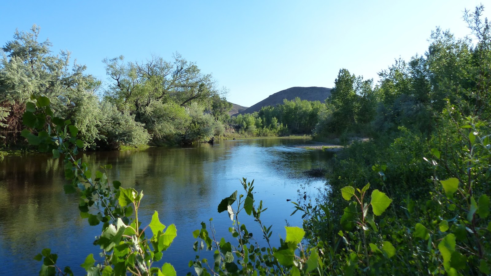
We had a nice walk on the trails along the Carson River and around the ruins, with nothing but the sound of birds. We never heard a train on the nearby tracks. The cats loved it there.


Jim checking out the former hospital


Highway 50 didn’t really become lonely until we got east of Fallon, the largest town along the route, a big agricultural community and home to the Navy’s Top Gun flight school. After that we would go miles without seeing another car, and enjoyed the scenery as we climbed several summits, the last one being the 7,400’ Austin Summit in the Toiyabe Range. 

Popular with the OHV crowd, Sand Mountain dunes 25 miles east of Fallon.
A very lonely section of Route 50.

We stopped just east of Austin Summit at Bob Scott Campground, a small forest service campground not far off the road, where we found lots of dirt roads and cattle trails to take an evening walk in the woods.


Today we're on the move another 150 miles or so east, and it looks like we’ll be out of Verizon range for awhile. We saw that Google and Microsoft are working on a fix for the Windows Live Writer issue, so I’m hoping by the next time I post it will be working as usual. It takes me way too long to add photos directly to Blogger.


Thursday, May 28, 2015

A Good Week


Please excuse the layout of this post since I'm writing it directly to Blogger. Windows Live Writer is down and it seems impossible to get text and photos where I want them with Blogger.

In spite of six straight days of rain we really enjoyed our stay at Washoe Lake State Park. It was barely half full over the holiday weekend and blissfully quiet. We had great next door neighbors, Terry and LuAnn, who braved the dark clouds and threats of rain to join us on several walks in the park and up the surrounding hills, and drank our beer;-)


We got rained on every hike except one, the worst being one last hike after Terry and LuAnn left, where we were caught in the middle of a thunderstorm about a mile from home. Jim has threatened to never hike again when storms are predicted. We’ll see how that goes!


A few more photos from our treks around Washoe Lake.
LuAnn, Terry and Jim, checking out the lake. In spite of all the rain it was still mostly dry. We would love to return here one day when it’s full.


There are miles of trails and dirt roads to explore.


Not sure whose well-maintained grave this is along the Deadman’s Creek trail.


 There is a nearby hang glider launch and landing pad right in the park.


One day we did some shopping in Reno, where you will find just about every store known to man. Another day we visited Carson City to wander the streets of the historic downtown and check out the state capitol building. The second floor has a historical museum, and we were surprised to be able to walk right in the building without being checked by security or passing through a metal detector.


We really liked Carson City and the surrounding area and think this might be a nice place to live. One of these days we’d like to come back and spend more time. It’s small enough that it’s easy to get around, there isn’t much traffic, it has a Trader Joe’s and Costco and nearby Reno has everything else if you need it, and is close to the Sierra Nevada mountains and Lake Tahoe to escape the summer heat. Also Nevada has no state income tax. Lots of plusses, although the winters get pretty cold.

Since we reached our seven day limit at Washoe Lake SP, yesterday we moved east along Nevada Hwy 50 working our way to Great Basin National Park. Hector and Brenda posted a great write-up and photos from their drive a few weeks ago but if anyone has ideas of places to stay or things we shouldn’t miss along the Loneliest Road, please leave a comment.

Saturday, May 23, 2015

Sending Out an SOS


images (3) InReach SE close

For a long time now I have thought it would be a good idea to have one of three devices for use in an emergency when there is no cell service available. We find ourselves in that situation frequently in our travels and hikes. I kept putting it off because, for me, it felt like spending money on yet more insurance that you hope you will never have to use.

The devices are a Personal Locator Beacon or PLB such as these.

PLB

Or a Spot Gen 3

Spot

They all work on satellite networks although different networks. Here is a very good review of your options.

For us the deciding factor was two way messaging and we chose the Delorme InReach SE. The Spot allows for one way pre-set messages for a total of three. They are pre-configured both in regards to message and recipient.  The Delorme InReach SE allows texts up to 160 characters which can be sent via satellite to any email address or text capable phone. In addition, if you do hit the SOS button you can send and receive texts from emergency responders.

The advantages to the PLB are a stronger transmit signal and no contracts or monthly fees. The Spot and InReach require activation and a fee to work. The spot fees can be as low at $99.99 per year and the InReach can be as low as $11.95 per month. InReach does have an option to go without a contract and thus go month to month which includes an annual fee of $24.95 plus the cost for whatever plan you use. The least expensive of the no contract Freedom Plans are $14.95 per month.

An additional plus for the InReach is that you can download an app for IOS or Android. You can sync your phone and the InReach via bluetooth and from within the app send your text messages. The benefit in this is a larger screen and better typing interface. There are additional features using this set up but I won’t go into them now as I haven’t fully utilized them. It includes downloading Delorme Topo maps to the phones app.

Both the Spot and the InReach allow your tracking to be viewed via website for friends or family if you choose.

In the end, though, the primary purpose for these devices is to get emergency help when you need it and have no cell service. I want the added benefit of being able to communicate both directions to know that help is on the way and to be able to provide information to responders that will assist them in understanding the severity and nature of the emergency. Even though Gayle and I are almost always hiking or biking together we wouldn’t want to have to leave the other one injured to walk or bike out miles for a cell signal to call for help.

If you have any interest in either the Spot or the InReach I encourage you to go to Amazon or REI, as examples and read reviews as well as the excellent review I linked to earlier.

Of course, here’s hoping that the only use we ever make of it is a text to Mark and Bobbie telling them I will be late as usual getting to the trailhead.

Friday, May 22, 2015

Washoe Lake State Park, Nevada Via Lake Tahoe


P1000925

It was another early departure for us on Tuesday, hooked up and leaving Glory Hole Recreation Area before 9:30. Based on advice from a friend we decided to head east on 88 over 8,600’ Carson Pass and rain was predicted after 11. Just before we got to the pass it started raining lightly but we drove out of it. We were a little concerned about the road becoming icy since it was so cold. There are lots of forest service campgrounds along the way but not even a consideration in this kind of weather.

DSC01568

It was a pretty drive and the road was not bad considering the elevation gain and loss.

 DSC01565

Since we’d never been before we decided to spend a night at a Passport America park in South Lake Tahoe, CA to check it out. It was only in the 40s and rain was in the forecast but we got to Tahoe Valley RV Resort before it began. I forgot to take photos but remembered the next morning as we were pulling out. Sites are squeezed in among the pines on the dirt. The only “resort” feature we took advantage of was the laundry, which was cheap and adequate, so we got that out of the way.

DSC01577 

We decided to go for a walk to see if we could find the lake, which looked to be fairly close, but it started raining and we realized we were actually at least a couple miles from the water so we turned back and got the car. Found a park to the east where it was not raining and a pleasant trail along the lake.

DSC01570

This appears to be a really bike friendly area, with trails and bike lanes everywhere, although it is probably so crowded in the summer it wouldn’t be much fun.

DSC01572

The next morning we took off for a short drive to Washoe Lake State Park near Carson City, Nevada. Paul and Nina (Wheeling It) recommended this park, and I called to see if we would have any trouble getting a site before the holiday and was assured it should not be a problem. Probably because there is not a drop of water in the lake right now, but water or not, as soon as we drove in we knew we were going to like it here. Huge sites, 360 views, and very few people. It reminds us of our favorite park, McDowell Mountain in Arizona, minus the saguaro cactus.

P1000945

The rain began shortly after we arrived but it cleared up a couple hours later so we managed to take a hike on the beach trail, through the lake, and back over the dunes.

P1000928 

Jim standing in the middle of dry Washoe Lake.  

 P1000934

Being a shallow lake (only 12’ when full), and depending on snowpack for its water, of which there was little this year, it is not uncommon for the lake to dry up. Apparently it’s happened several times since the 70s.

P1000933 

P1000941

P1000944 

P1000940 

Terry and LuAnn (Paint Your Landscape) arrived here yesterday, being driven out of Lee Vining by the weather, and just as they got here we had a phone call from our Lazy Daze friends Robin and Lydia from Ridgecrest, wondering where we were. They were on their way up 395 heading to Santa Rosa and thought we might be along their route. So they ended up stopping here for the night and we had a nice visit with them and their new kitten last evening. Never know who we’ll run into, even in what feels like the middle of nowhere.

P1000939

Monday, May 18, 2015

Glory Hole Recreation Area, Angels Camp, CA


P1000880

We headed out of Yosemite by 9:30 on Thursday morning with the threat of rain and/or snow looming overhead. Our new mifi device was waiting for us at the post office in the Mother Lode town of Sonora, CA, nearly eighty miles away. The most exciting part of the drive along 120 was coming down the one hundred plus curves and hairpin turns of Priest Grade, with me in the lead in the car. I was very glad we didn’t hook up. We spent that night at Marble Quarry RV Park in Columbia, just a few miles from Sonora. It’s a Passport America park and our site was actually quite nice for an RV park and the $22.50 price. It began to rain shortly after we arrived and continued all night so I failed to take any photos. We definitely timed it right getting out of Yosemite when we did.

It was only in the mid forties but after the post office we walked in the cold rain through historic downtown Sonora, a cute place with mostly antique and specialty shops, but Jim did buy a new pair of hiking pants in the outfitter store. The RV park happened to be located just a few blocks from Columbia State Historical Park so I suggested we stop on the way back. Jim stayed in the car while I donned my rain gear and wandered around the streets of the preserved California Gold Rush-era town, which looked more like a ghost town on this dreary day.

 DSC01550

DSC01549

DSC01551

DSC01553

DSC01554

The next day we were in search of a quiet place to relax and spend the weekend, so we drove 18 miles to Glory Hole Recreation Area on New Melones Lake, where we found a great campsite overlooking what’s left of the lake at 25% capacity.

P1000883

Jim had long grown tired of too many days of being parked in the forest, but I didn’t realize how much it was affecting my mood, also, until we got back in the wide open grasslands. Wild turkeys wander by frequently, there is an osprey nest with babies just at the end of our loop, and miles of trails, so we’ve hung around a couple more days.

P1000904 

P1000892 

This area used to be part of the lake.

P1000884 

P1000885

 Houseboat owners have been asked to get them out of the water before the lake turns to mud. Most have been moved to dry storage but there were still a few left.

P1000889

P1000891

Yesterday we took a drive to check out nearby Angels Camp and San Andreas, two more Gold Rush towns along Highway 49. We spent a couple hours at the Calaveras County Museum in San Andreas, a nicely done historical museum if you care to learn more about this part of California’s prosperous gold days.

Glory Hole Recreation Area, Angels Camp, CA

Angels Camp’s claim to fame is that Mark Twain based his first famous short story, The Celebrated Jumping Frog of Calaveras County, on a story he heard at Angels Hotel in 1865. They now have an annual frog jumping contest in May, which happened to be taking place over the weekend, but we didn’t attend. They like their frogs here.

Glory Hole Recreation Area, Angels Camp, CA1

Tomorrow we move north in search of a place to hide out for the upcoming holiday weekend.